The climate of Okanogan County is characterized by warm, dry summers and relatively cold winters. Hot, summer days are common, reaching an average maximum July temperature of 92.1 F in lower valleys. The January minimum average is 17.4 F in lower elevations. The average mean low is 24.2 F., and the average mean high is 75.0F. The average mean range is about 50 F. However, highs above 100 F. and lows down to -30 F. are not uncommon in outlying and higher elevations. Highest recorded temperature is 114 F., and the lowest is -23 F., but this is only at a recording station. It is typical for the temperature to stay in the single digits or low teens for several weeks during the winter months. Here are some temperature from four month and there average of them in January the maximum temperature was around 31.0 and the minimum temperature was 17.4 the mean temperature was 24.2 for April the maximum temperature was 67.8 and the minimum temperature was 38.4 the mean temperature was 58.1. The ones from July the maximum temperature was 92.1 and the minimum temperature was 57.9 the mean temperature is 75.0 now there was a big change there it got a lot hotter than the other months the last month is October the maximum temperature was 65.2 the minimum temperature is 38.6 the mean temperature is 51.8 that's the temperature for you.
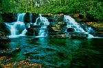
Now moving on to the geography of the Okanogan it has mountains and valleys on the west side and it’s flat to the east it's more like dessert and it’s very rocky the vegetation is thinner it has different kinds of trees it has pine trees but different then our pine trees.There's really not that much about it. The land has a lot of bumps in it and hills. The city lies in a fertile agricultural bowl, ideal for orchards and vineyards, sheltered by ridges of dry grassland, ponderous pine, and Douglas fir forest that rise to forested highland plateaus. Here the rolling terrain is punctuated by small fishing lakes and the occasional mountain peak like Big White.Stroll the boardwalk in the Rotary Marshes at the mouth of Brandt's Creek (at the north end of downtown) where waterfowl nest in the wetlands and an osprey platform is occupied every summer. Hike or cycle the Mission Creek Greenway, which borders the largest tributary of Okanogan Lake. This is an important kokanee salmon spawning stream. Kelowna is located midway along the shores of Okanogan Lake in the Okanogan Valley. The Okanogan Valley is part of British Columbia’s Plateau is characterized by a string of lakes created by glaciation. This glacial activity occurred during the Tertiary and Quaternary periods where mile-thick ice layers retreated 10,000 years ago, scraping the surface and leaving behind valuable sedimentary deposits along its borders. Additional mountain river and flooding left behind nutrient and mineral rich soils which today still form the foundation of the Okanogan’s successful agricultural economy. Okanogan Lake, the largest of the lakes, is 110 km (68 miles) long and ranges from about 3.2 to 6.4 km wide. East of Okanogan Lake are Swan, Kalamalka (a Salish word meaning lake of many colours) and Wood lakes. To the south are Skaha, Vaseux and Osoyoos lakes. The system drains south into the Okanogan River, crosses the border into Washington, and joins the Columbia River. The Columbia then veers west and carves a path through the Cascade and Coast Mountain ranges to drain into the Pacific Ocean.Three mountain ranges surround the region: the Columbia Mountains, a range of the Rockies, and comprised of the Purcell, Selkirk, Monashee and Cariboo sub-ranges lay to the east of the Okanogan Valley; the Cascade Mountains, specifically the Okanogan, Hozomeen and Skagit ranges, from the south-western border ; and the Coastal Mountains are to the west.
Now moving on to the geography of the Okanogan it has mountains and valleys on the west side and it’s flat to the east it's more like dessert and it’s very rocky the vegetation is thinner it has different kinds of trees it has pine trees but different then our pine trees.There's really not that much about it. The land has a lot of bumps in it and hills. The city lies in a fertile agricultural bowl, ideal for orchards and vineyards, sheltered by ridges of dry grassland, ponderous pine, and Douglas fir forest that rise to forested highland plateaus. Here the rolling terrain is punctuated by small fishing lakes and the occasional mountain peak like Big White.Stroll the boardwalk in the Rotary Marshes at the mouth of Brandt's Creek (at the north end of downtown) where waterfowl nest in the wetlands and an osprey platform is occupied every summer. Hike or cycle the Mission Creek Greenway, which borders the largest tributary of Okanogan Lake. This is an important kokanee salmon spawning stream. Kelowna is located midway along the shores of Okanogan Lake in the Okanogan Valley. The Okanogan Valley is part of British Columbia’s Plateau is characterized by a string of lakes created by glaciation. This glacial activity occurred during the Tertiary and Quaternary periods where mile-thick ice layers retreated 10,000 years ago, scraping the surface and leaving behind valuable sedimentary deposits along its borders. Additional mountain river and flooding left behind nutrient and mineral rich soils which today still form the foundation of the Okanogan’s successful agricultural economy. Okanogan Lake, the largest of the lakes, is 110 km (68 miles) long and ranges from about 3.2 to 6.4 km wide. East of Okanogan Lake are Swan, Kalamalka (a Salish word meaning lake of many colours) and Wood lakes. To the south are Skaha, Vaseux and Osoyoos lakes. The system drains south into the Okanogan River, crosses the border into Washington, and joins the Columbia River. The Columbia then veers west and carves a path through the Cascade and Coast Mountain ranges to drain into the Pacific Ocean.Three mountain ranges surround the region: the Columbia Mountains, a range of the Rockies, and comprised of the Purcell, Selkirk, Monashee and Cariboo sub-ranges lay to the east of the Okanogan Valley; the Cascade Mountains, specifically the Okanogan, Hozomeen and Skagit ranges, from the south-western border ; and the Coastal Mountains are to the west.
